


The National Parks – Zion
 The National Parks – Zion
gearweare.net
The National Parks – Zion
gearweare.net
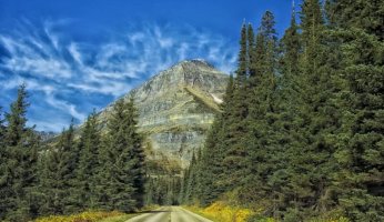
Zion National Park is an oasis of canyons formed by the Virgin River and its tributaries. These water features, which shaped and continue to shape the canyons, have made possible the diverse ecosystems found within the park. Spanning 232 square miles and containing elevations ranging from 3,666 to 8,726 feet above sea level, Zion contains a multiplicity of flora and fauna native to desert, riparian (river-bank), and pinyon-juniper and conifer woodland bionetworks. The soaring sandstone cliffs that extend as high as 2,000 feet into the air offer a stunning backdrop to this biodiversity. Together, these features of the landscape unequivocally make Zion one of the most beautiful national parks.
This park also has a rich cultural history. Human activity in the region can be traced as far back as 6,000 B.C.E. These first peoples were nomadic hunters, who eventually adapted to become farmers about 2,600 years ago. The unique topography of the Zion area made it well suited for farming, a rarity in this arid part of the US. The Native American tribes that lived here included the Anasazi and the Paiute peoples. The park is filled with their artifacts, however, in an attempt to preserve the history, most are not open to the public. When visiting an open site, make sure to remain respectful, refraining from touching anything or leaving any traces of your visit. Inquiries about which archeological sites are open should be made with the Zion Visitor Center.
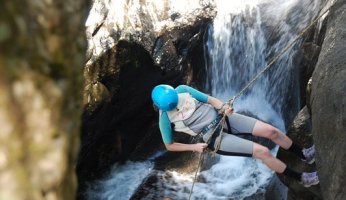
The activities that you can do in Zion National Park are diverse, ranging from rock climbing and canyoneering to backpacking and biking. Below you will find some of the best areas to check out during your visit to this park. These activities found in these spots range in terms of necessary fitness and skill levels, so everyone should be able to find something to do.
Table of Contents
Angel’s Landing
A trip to Zion is not complete without hiking this iconic trail. This out and back path only covers a total of 5 miles, but be prepared to climb almost 1,500 feet in elevation. Anyone with a severe fear of heights should also be prepared for intense exposure as you move along a cliff face with sheer drop-offs. Metal chains have been bolted into the rock along the trail to assist hikers, but anyone who may be too afraid should still think about opting out of the last part of the hike.
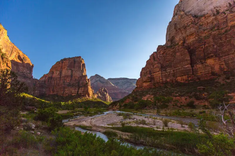
The last section of this trail moves from Scout Lookout to the Angel’s Landing Summit. It is only half a mile long, but requires you to traverse a saddle with drop offs on each side and then climb the hogsback, a ridiculously steep rock formation. However, conquering the fear is worth it once you achieve the summit and get to experience the incredible views of Zion Canyon spread out before you.
The Kolob Canyons
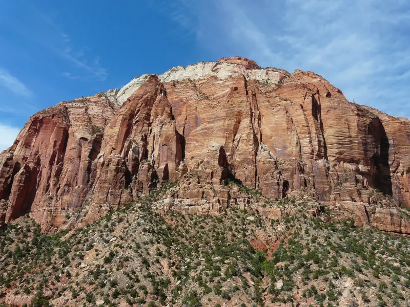
Located in the northwestern corner of Zion National Park, the Kolob Canyons are a bit of a trek from the more popular parts of the park. However, the scenic Kolob Canyons Road makes getting into this area no more difficult than a long car ride. The remoteness of the entrance also means that fewer people visit this part of the park, making it the perfect destination for anyone trying to avoid crowds.
The Kolob Canyons themselves are a series of narrow parallel box canyons that were cut into the western side of the Colorado Plateau. The way the canyons were formed has also populated the area with sweeping peaks and massive cliff faces, some of which are 2,000 feet tall. In this part of the park you will find access to the backcountry of Zion, as well as a few day hikes that take you into the canyons. You can also find the Timber Creek Overlook Trail, which is an easy 1-mile hike that leads to incredible views in every direction. From this spot, you can even see Mt. Trumbull, located 100 miles South on the North Rim of the Grand Canyon.
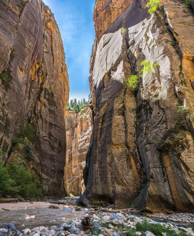
The Narrows
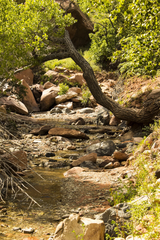
At the end of Zion Canyon Scenic Drive you will find the Narrows. It is at point that Zion Canyon becomes quite thin, sometimes only 20 or 30 feet across. The Narrows extend up the canyon to the north until it exists the park near Chamberlain’s Ranch. Hiking the Narrows involves walking in the Virgin River, and is a very popular activity within the park. Since the hike is out and back with no real end point, visitors can make this trek as difficult or easy as the want.
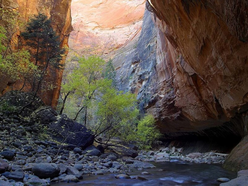
The easiest way to access the Narrows is from the South. The trail begins at the Temple of Sinawava, an impressive sandstone rock formation that is worth a visit to this part of Zion on its own. You will then take the paved Riverside Walk for the first mile. Once you reach the end of this short trail, it’s time to put your feet in the water. Continue up the Virgin River for as long as you please. Two popular destinations are Oderville Canyon, which is 2.5 miles from the Riverside Walk trailhead, and Big Spring, which is another 2.5 miles past Oderville. Walking up Oderville Canyon or past Big Spring is prohibited.
The other option for exploring the Narrows is to enter from the north. This trip requires a permit and is often done in two days. You will enter the Narrows just outside of Zion, at Chamberlain’s Ranch Trailhead, and exit the Narrows where the most people enter, at the Temple of Sinawava. These two locations are an hour and a half drive from each other, so make sure to plan a way to get back to your car. The hike from the top down covers 16-miles and is quite strenuous. Although some choose to complete the entire thing in one long day, an overnight trip is both more comfortable and safer. There are 12 campsites within the Narrows. Your hiking permit does not cover the sites, so making a reservation beforehand is recommended.